
-
About Union
Geographical & Economics
History & Culture
Miscellaneous
-
Union Council
Union Council
Activities of Union Council
Village Adalat
-
Govt. Office
Agriculture
Land
Helath Services
Social Service
-
Other Institutions
Educational Institutions
Organizations
-
Different Lists
Relief and Rehabilitation
Women affair
Rural Development Project
Other listings
- Projects
-
Service
UDC
National E-Service
Mobile App
Important Software Downloads
- Gallery
-
About Union
Geographical & Economics
History & Culture
Miscellaneous
-
Union Council
Union Council
Activities of Union Council
Village Adalat
-
Govt. Office
Agriculture
Land
Helath Services
Social Service
-
Other Institutions
Educational Institutions
Organizations
-
Different Lists
Relief and Rehabilitation
Women affair
Rural Development Project
Other listings
- Projects
-
Service
UDC
National E-Service
Mobile App
Important Software Downloads
-
Gallery
Photo Gallery
Video Gallery
(26/10/2013 according to the on-line information) (male number - 4526 people, women number - 21020), total: 45146
|
01 |
Union Name- |
12 No. Charshahi Union Parishad, Post Office- Charshahi Thana: Chandraganj, Upazila: Lakshmipur Sadar, District: Lakshmipur |
|
02 |
Location and Size- |
Located at Basurhat Bazar under Chandraganj Police Station under Lakshmipur Sadar Upazila. The length is 6 km, the fourth 4.00 km, 18.80 square kilometers. Distance- 21 km from the district headquarters |
|
03 |
Border-
|
Answer: Chandraganj Union No 10, Sadar, Lakshmipur |
|
04 |
According to the birth registration register population- |
|
|
05 |
Number of voters |
(Total: 19415) Male voters - 9563, Female voters number 9852 (According to the 2016 data). |
|
06 |
Total family/people - |
According to Holding No. - Total: 7324, (According to the 2007 data). |
|
07 |
Human resource- |
Chairman 01, UP Male Member 09, U.P. Female Member 03, Secretary 01, Entrepreneur 2, Daphdar 01, Village Police 9. |
|
08 |
Village-13 |
1. Nurulapure, 2. Charshahi, 3 Small vallabpur, 4 East Jafarpur, 5. Rahimpur, 6. East Shahapur, 7. Titarkandi, 8. East Saidpur, 9. Rampur, 10. Jaliakandi, 11. Itchola, 12. Gobindapur, 13. Jagannathpur |
|
09 |
Ward-09 |
Ward no. 01; Ward no. 2; Ward No. 2; Charshahi; 3; Ward-Charshahi and small Bhawabpur; 4 ward-East Jafarpur; Rahimpur; East Shahpur; Ward-Titarkandi; 5; Ward-East; Sayedpur; 7 ward; Syedpur; 8; Ward - Rampur; Jaliakandi and Itkhola, 9 ward-Govindapur and Jagannathpur. |
|
10 |
Mouja-13 / Land Amount- |
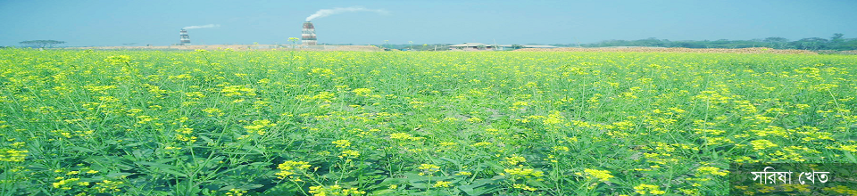
A total of 4272 acres (including pond water) 966 hectares of land, one crop land - 42 hectares, two crop land - 811 hectares, three crop land - 116 hectares, annual food demand - 152 million tons. Aus 100 hectares, aman-935 hectares, boro 650 hectares. |
|
11 |
Educational institutions and education rate- |
**College: 01 Publicity Degree College **Primary School - 20
|
|
12 |
Madrasa / Orphanage Total - 40 |
Dakhil Madrasa-4, |
|
13 |
Kindergarten- 6 |
(1) Basurhat Futures Cadet School |
|
14 |
Health care |
Community Clinic 4 (a) Nurulapur Community Clinic (b) Charshahi Community Clinic (c) East Syedpur Community Clinic (e) Rampur Community Clinic. |
|
15 |
Government office |
(1) Dasarhat police ferry (2) Land office (3) Agriculture office (4) Health service office (5) Social service office |
|
16 |
Market-05 |
01. Basurhat Bazar, 02 Dasarhat Bazar (Growth Center), 03 Bhuiyan Hat, (4) Miyar Bazar (5) New Hats. |
|
17 |
Bank-02 |
01. Agrani Bank, 02. Janata Bank |
|
18 |
Insurance company - 4 |
(A) Forward Life Insurance (B) Pragati Life Insurance (c) Popular Life Insurance, (d) National Life Insurance |
|
19 |
Rural Savings Bank- 1 |
It is a government association under which there are 120 people in each ward (a house a farm project - loan assistance organization) |
|
20 |
NGO Institution-07 |
(A) Bureau (B) SS (C) BRAC (D) Codex (E) Revival (F) Rural Bank (H) TMS |
|
21 |
Religious Institution |
Mosque 63. Temple 3 |
|
22 |
Government approved seed / fertilizer / retail sales center |
Seed sales center -03, fertilizer distribution center -03, retail outlets -03, low-cost rice sales center -01 |
|
23 |
Water management projects and tube wells |
Water Management Project-9 Tube well-110 |
|
24 |
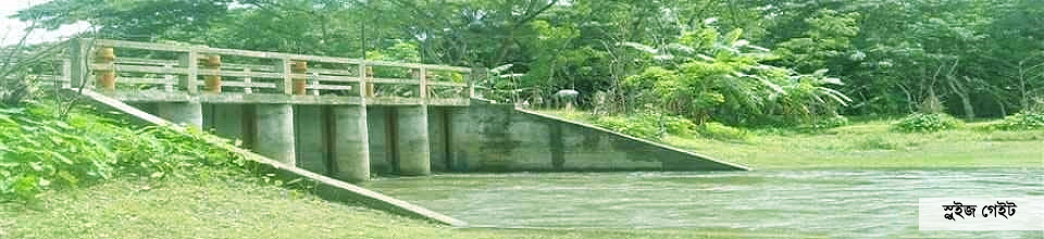
Number of roads / bridges / canal ponds |
15 bridges, culvert-30, |
|
25 |
Industrial factory |
Brick Field 02 (A) Sonali Brick Field (B) Shapla Brick Field. Dairy farms 01, poultry farms 5 |
|
26 |
Historical place (shrir) 2 |
(A) |


Planning and Implementation: Cabinet Division, A2I, BCC, DoICT and BASIS
Technical Assistance:
![]()
Developed By:
